
Sentinel-3 - Remote Sensing Data
Global analysis ready multispectral satellite data from Sentinel-3 satellites. The Sentinel-3's Ocean and Land Colour Instrument (OLCI) sensor provides data with low spatial resolution (~300m pixels)...
European Space Agency
Creative Commons Attribution 4.0 International (CC BY)
Coromandel River and Rain Gauge Time Series
This dataset contains ten-year historical river and rain gauge measurements from the Coromandel region. These measurements being water stage values recorded from the Tairua, Opitonui and Kauaeranga ri...
Waikato Regional Council
To Be Determined
GPATS Oceania Lightning Feed
Archive of lightning records and live feed for Oceania area. Spanning February 2004 to the present day.
MetraWeather Australia
Non-standard
Images of Wildlife from Cameras
The WCS training set contains 217,959 images from 441 locations, and the WCS test set contains 62,894 images from 111 locations. These 552 locations are spread across the globe. You may also choose...
N/A
Creative Commons Attribution 4.0 International
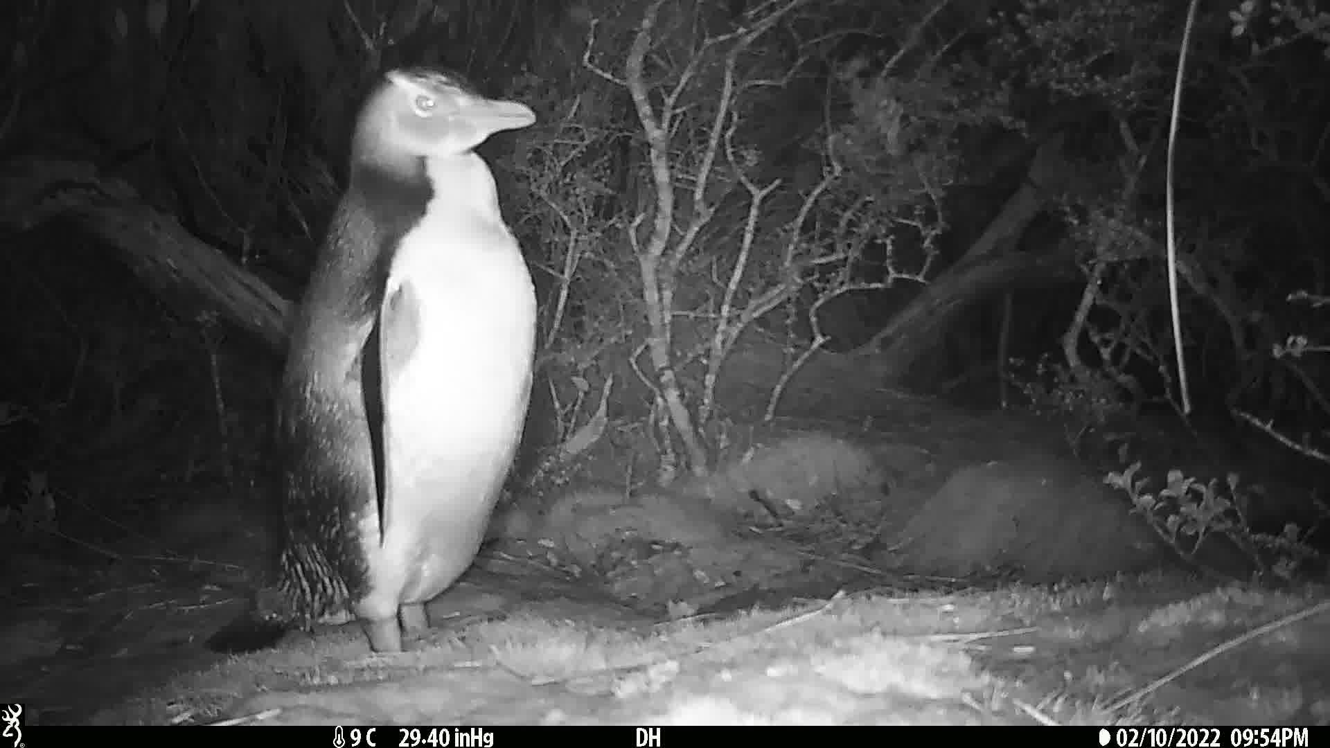
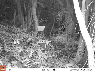
Predator camera images
Images of predators species extracted from camera trap video taken in the Karioi region from 2018-2020. This data is available in PNG files, with the folders defining the classes (predator species) o...
Waikato Regional Council
Creative Commons Attribution 4.0 International (CC BY)
LILA Wellington Camera Trap
This data set contains 270,450 images from 187 camera locations in Wellington, New Zealand. The cameras (Bushnell 119537, 119476, and 119436) recorded sequences of three images when triggered. Each se...
Victor Anton, Stephen Hartley, Andre Geldenhuis, Heiko U Wittmer
Creative Commons Attribution 4.0 International
Crown-of-Thorns Starfish
Images of crown-of-thorns starfish predators taken from the Great Barrier Reef. This data contains three folders with sample image sequences of swimming across coral reefs.
The CSIRO Crown-of-Thorn Starfish Detection Dataset
Creative Commons Attribution 4.0 International (CC BY)
LCDB and Waikato Regional Aerial Photography (2017)
Land cover database (LCDB) and Waikato Regional Aerial Photography paired imagery for the Waikato region taken in 2017. This data is available in PNG files, with the folders defining the classes (lan...
TAIAO Project
Creative Commons Attribution 4.0 International (CC BY)
Himawari 8 Weather Satellite
The Himawari-8 weather satellite is a geostationary satellite owned and operated by the Japan Meteorological Agency (JMA) and provides data covering East Asia, and includes the West and central Pacifi...
Japan Meteorological Agency
Non-standard, Creative Commons Public Domain Dedication 1.0 Universal (CC0 1.0)
Bay of Plenty Water Quality and Discharge Data
Collection of data sources reporting on Water quality and Discharge rates within the Bay of Plenty region.
Bay of Plenty Regional Council
Non-standard
Aggregated interpolated wave and Atmospheric forecast
This dataset provides waves and atmospheric statistics interpolated at any location on Earth. The data in this dataset comes from multiple sources and is generated by numerical models solving the fund...
MetOcean
To Be Determined
Air Quality Monitoring in Vinnytsia city and region
The dataset contains data from the public monitoring of network air quality in the city of Vinnytsia (Ukraine) (population - about 400 thousand, regional center).
https://www.saveecobot.com/
Creative Commons Attribution-NoDerivatives 4.0 International (CC BY-ND)
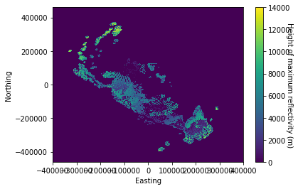
NZ MetService Rain Radar Network
This dataset is an archive of data from the MetService doppler radar network. [Sample Data](https://github.com/metocean/TAIAO/tree/master/data_connectors/nzradar_connector/sample_data)
Meteorological Service of New Zealand Ltd
Creative Commons Attribution-NonCommercial-ShareAlike 4.0 International (CC BY-NC-SA)
Trail Camera Images of New Zealand Animals
This data set contains approximately 2.5 million camera trap images from various projects across New Zealand. These projects were run by various organizations and took place in a diverse range of habi...
Department of Conservation, New Zealand
Community Data License Agreement – Permissive – Version 1.0
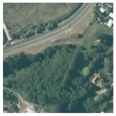
Auckland/Hamilton Aerial Photography
Archive of twenty-thousand aerial photographs captured at an altitude of one-hundred feet above sea level, together with corresponding port and starboard images offset at an angle of approximately 30o...
N/A
To Be Determined
Waikato Multi Label Aerial Imagery Dataset
Effective land use management is crucial for balancing development against environmental sustainability, preservation of biodiversity, and resilience to climate change impacts. Despite this, there is ...
TAIAO
Creative Commons Attribution 4.0 International (CC BY)
LINZ tidal gauge data
This data set is a collection of water level time-series measured by tidal gauges at a number of location around New Zealand (including Antarctica and Chatham Islands). Most time-series are over 10 y...
Toitū Te Whenua Land Information New Zealand
Creative Commons Attribution 4.0 International (CC BY)
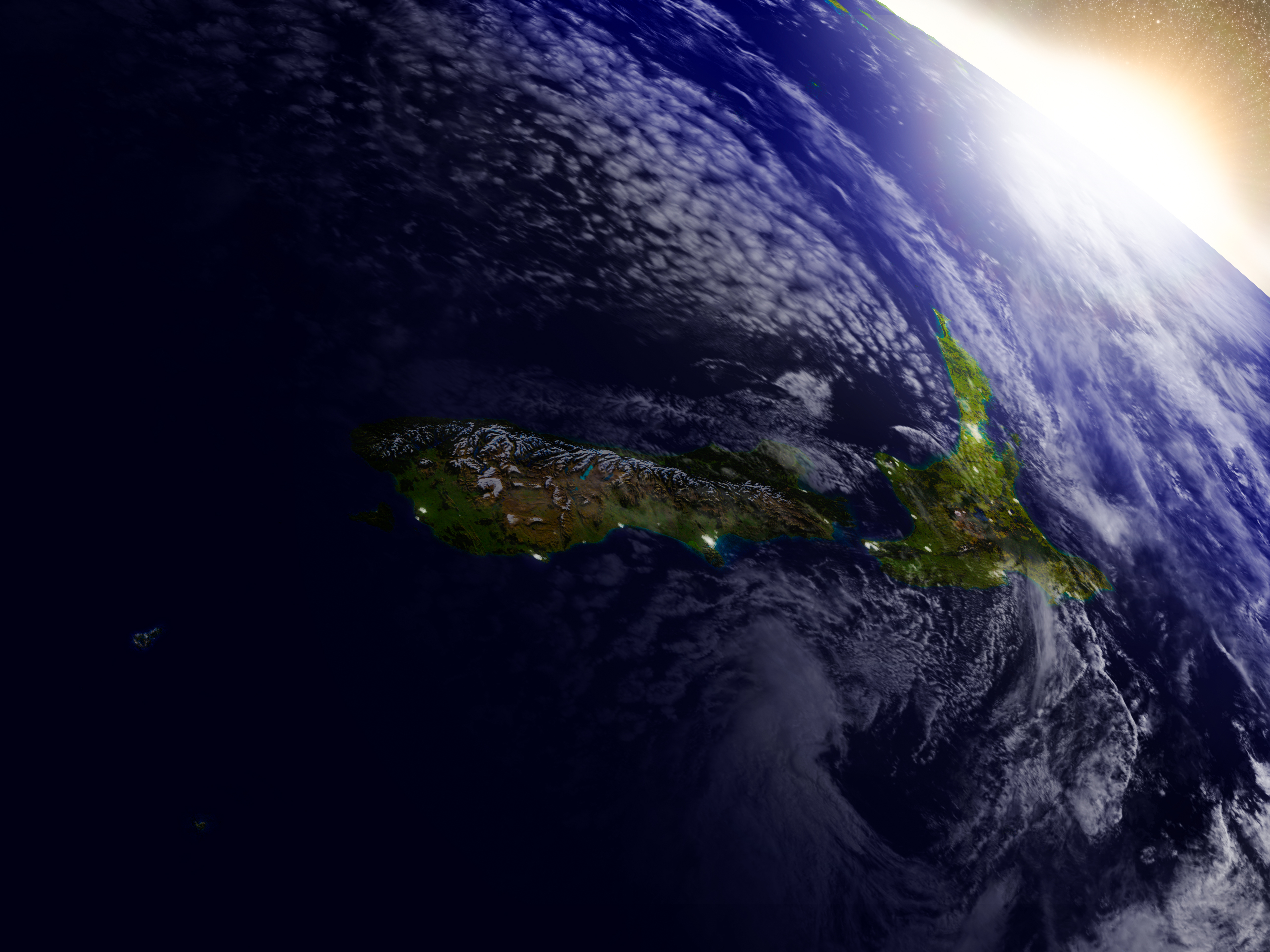
Sentinel Satellite snapshot of Waikato region
Spanning the period 2014 through 2020, focusing on the Lake Whangape area within the Waikato region of New Zealand, images captured by the satellites; [Sentinel 1](https://developers.google.com/earth-...
European Space Agency
Creative Commons Attribution 4.0 International
Mt Karioi Predator Project
This data set encompasses more than two-thousand one hundred, thirty-second video clips captured using Infra-red triggered Bushnell cameras. The cameras are distributed through thirty locations within...
N/A
To Be Determined
Google Earth Data Catalog
A multi-petabyte catalog of planetary scale satellite imagery and associated data products. Data sets are categorised into: Climate & Weather, Imagery, and Geophysical and include climate, weather, s...
Multiple
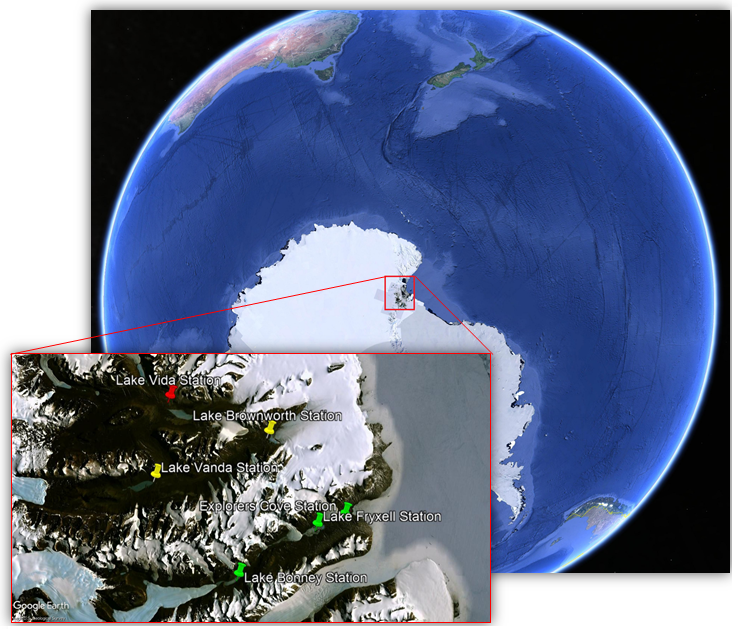
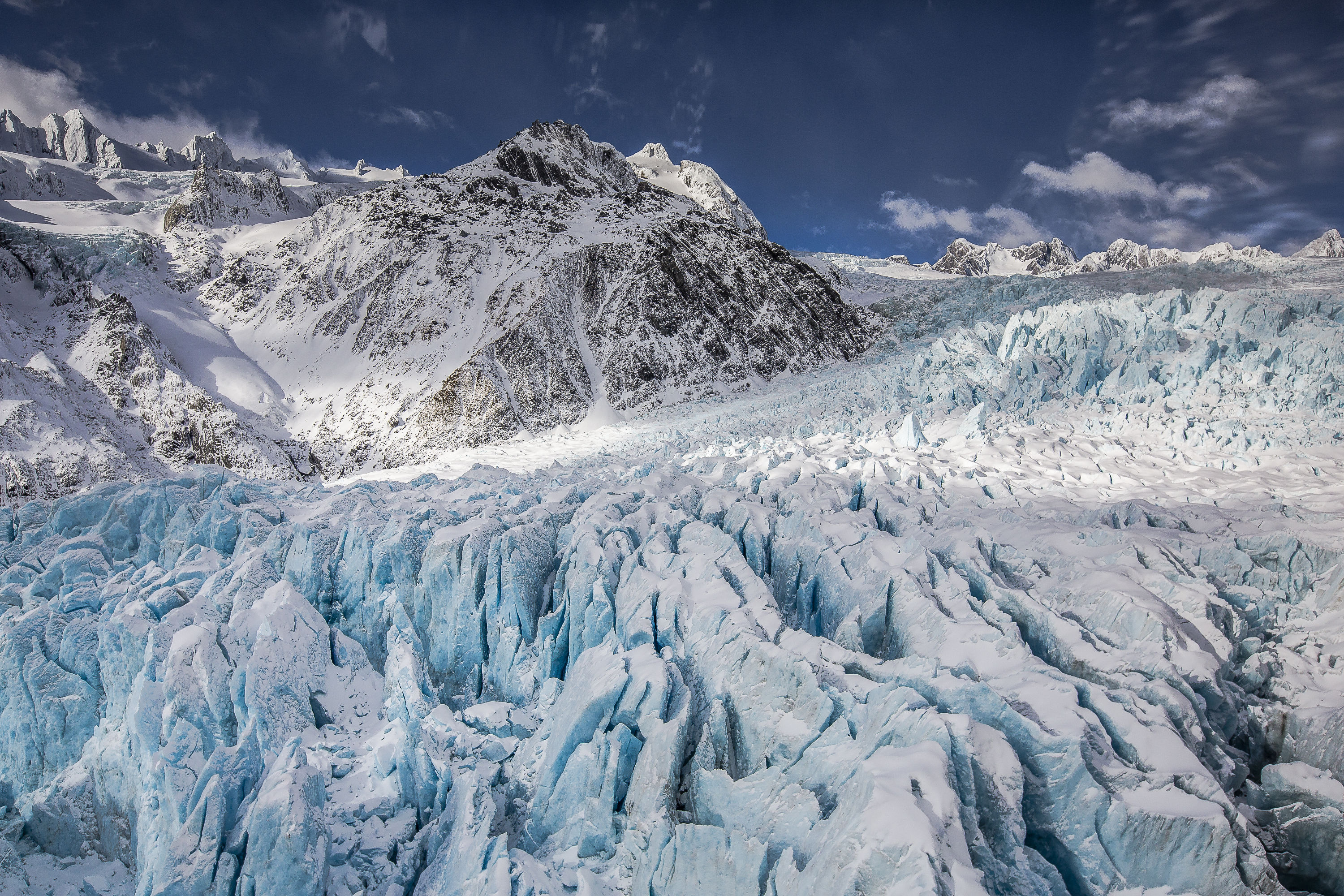
McMurdo Dry Valley Foehn Wind Dataset
Detecting foehn winds from time series data is challenging even for domain experts. Consequently, labelled data in this area is sparse, especially for Antarctica. This dataset combines several meteo...
University of Canterbury
Creative Commons Attribution 4.0 International (CC BY)
River and Radar sensor data (2015-2018)
Gridded rain radar, and river sensor information taken from August 2015 to January 2018, taken at 15 minutes samples. This data is available in CSV files: Column 0 contains the timestamp of the recor...
TAIAO Project
Creative Commons Attribution 4.0 International (CC BY)
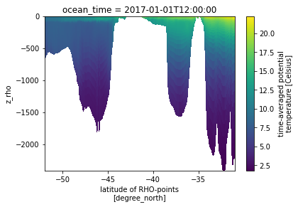
Moana hydrodynamic hindcast version 1.9
The Moana backbone hindcast version 1.9 dataset is a 25 year hydrodynamic hindcast of New Zealands water generated the Meteorological Service of New Zealand as part of the NZ MBIE funded Moana project...
Meteorological Service of New Zealand Ltd
Creative Commons Attribution-NonCommercial-ShareAlike 4.0 International (CC BY-NC-SA)
MetService Automatic Weather Stations hourly subset
Hourly subset of the MetService Automatic Weather Station (AWS) data as available on the Global Telecommunications System Data collected from an array of fixed weather stations located across the cou...
Meteorological Service of New Zealand
Creative Commons Public Domain Dedication 1.0 Universal (CC0 1.0)
MetService weather stations
MetService (Te Ratonga Tirorangi) compiled hourly data from weather stations around the country, with the data ranging from January 1993 to August 2022. The data is available in CSV files, one per we...
MetService
Creative Commons Attribution 4.0 International (CC BY)
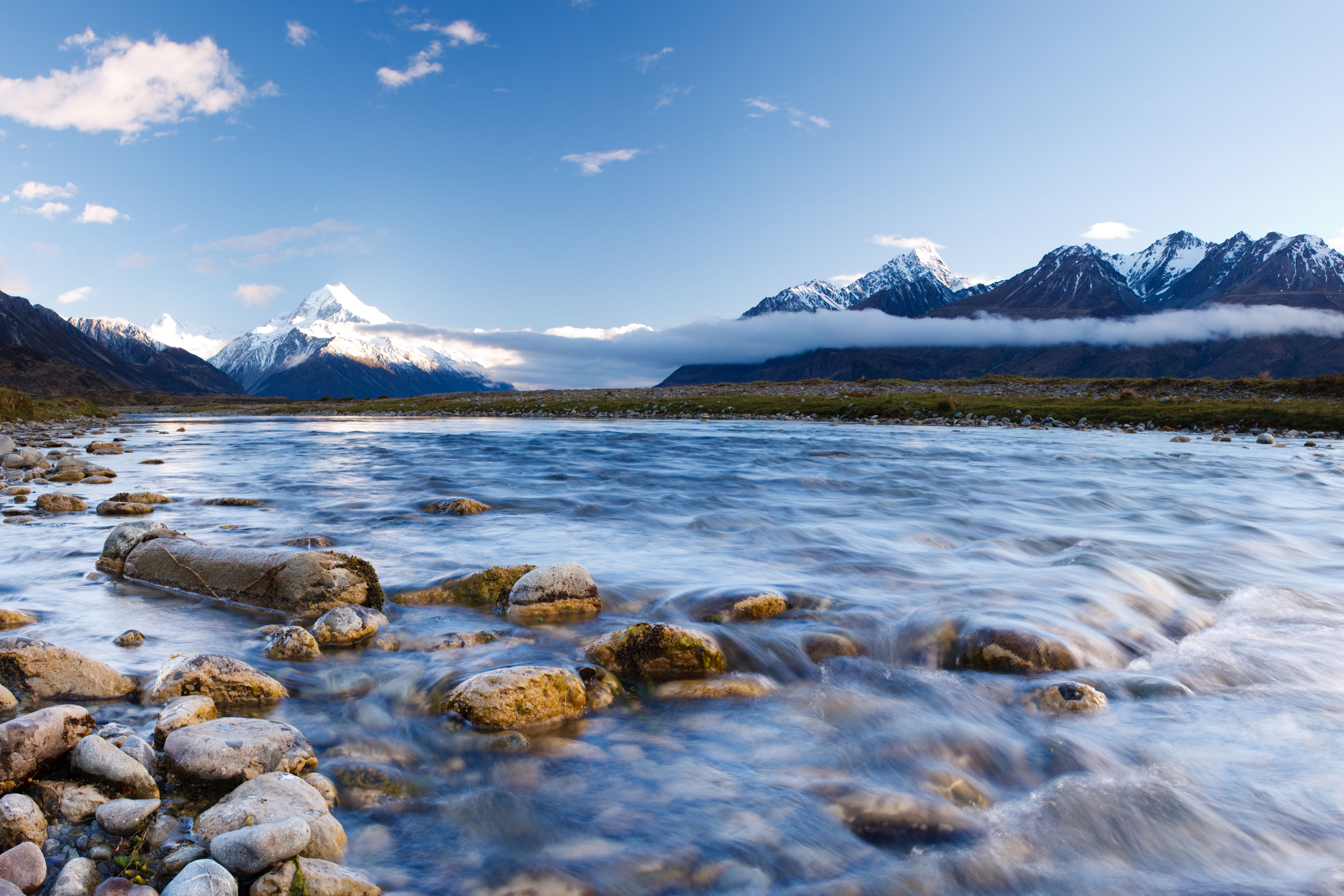
Global Topography
Topography measurement covering the entire surface of the globe. Data captured from the satellite includes: Topography metrics; ARD tile format. Extracted from the NASA Making Earth System Data Recor...
Global Land Analysis and Discovery Team, University of Maryland
Creative Commons Attribution 4.0 International
Kahikatea aerial imagery
This dataset contains images for Kahikatea (an indigenous plant in New Zealand) classification. Positive examples (in which Kahikatea trees can be identified) are annotated with true explanations suc...
Waikato Regional Council
Creative Commons Attribution-NoDerivatives 4.0 International (CC BY-ND)
New Zealand radiosonde (balloon flights) data
Weather balloons measuring upper air temperatures and winds are routinely launched from four stations around New Zealand. The four New Zealand upper air observatories at Raoul Island, Whenuapai, Para...
Meteorological Service of New Zealand
Creative Commons Public Domain Dedication 1.0 Universal (CC0 1.0)
Landsat 8 - Remote Sensing Data
Global analysis ready multispectral satellite data from Landsat 8 OLI sensor. Landsat 8 provides the capability to capture data medium resolution image data covering the global landmass.
N/A
Creative Commons Attribution 4.0 International (CC BY)
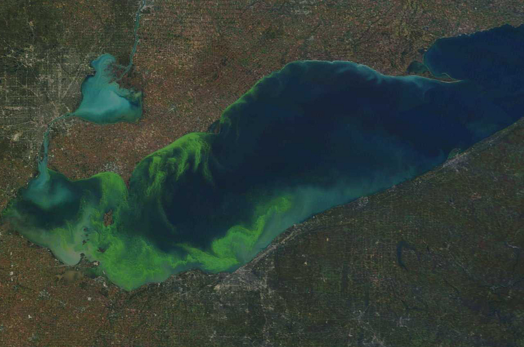
Estimating Chl-a from Remote Sensing - a CDE Machine Learning Approach
In this notebook, we explore state-of-the-art machine learning approaches to the task of estimating the concentration of chlorophyll-a (chl-a) from remote sensing data (satellites). The goal of this...
GNU GPLv3
Critter Detector
Below is a video from a camera trap set in New Zealand for which we wish to detect the species of critter in the video.
None

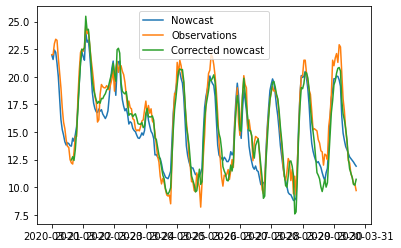
Predicting Extreme Events in Air Quality
In this notebook, we approach the problem of predicting dangerous events in air quality from land-based sensor data in urban centres. We employ continual learning techniques to reintroduce instances ...
Creative Commons Attribution-NoDerivatives 4.0 International (CC BY-ND)
Coasts and Ocean Collective database
-
None
Moana thredds server connector
This notebook describes how to get observation data from the thredds server set on top of the Moana 25 year hydrodynamic hindcast of New Zealand waters. The data is freely available from that server u...
To Be Determined, Creative Commons Attribution-NonCommercial-ShareAlike 4.0 International (CC BY-NC-SA)
NZ Metservice Rain Radar Network
-
None
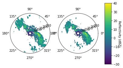
NZ radar raw data connector
This notebook describes how to work with the raw radar files produced by the MetServices rain radar network. It shows how to read them and interact with the key quantities to plot the data. The last p...
Creative Commons Attribution-ShareAlike 4.0 International, GNU GPLv3
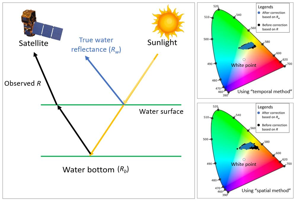
Removing the contribution of seabed reflectance to water reflectance
<!--StartFragment--> ## **To anyone who would like to use my model to correct water reflectance in the intertidal regions:** Lyzenga's model is widely used to estimate water depth or water reflectan...
Non-standard
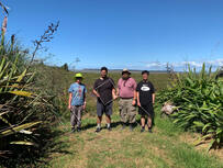
Scaling up Benthic Primary Productivity Estimates in a Large Intertidal Estuary using Remote Sensing
Zhanchao Shao, Prof. Karin Bryan, Dr Moritz Lemann, Georgina Flowers and Prof. Conrad Pilditch have been working together to develop a new methodology using machine learning and remote sensing data t...
To Be Determined
Taiao Case 4
-
None
MetOcean Solutions Observation API connector
This notebook describes how to get observation data from one of MetOcean Solutions' observation API. The data that can be accessed though the API come from different sources such as MetService's auto...
To Be Determined
MOA is the most popular open source framework for data stream mining, with a very active growing community.
This resource provides a demonstration of the capability for Machine Learning algorithms to provide a measure of understandability given the output from the algorithm.
WEKA (Waikato Environment for Knowledge Analysis) is an open source machine learning software in JAVA. It contains tools for data preparation, classification, regression, clustering, association rules mining, and visualization.
Enhanced machine learning library tailored for data streams
A Python package for online/streaming machine learning.
The Advanced Data Mining And Machine Learning System (ADAMS) is a flexible workflow engine aimed at quickly building and maintaining data-driven, reactive workflows, easily integrated into business processes, released under GPLv3.
Prediction of coastal flooding events within New Zealand. Important to have some capability to describe the event, and its impact on the environment. An area of particular concern is the estimation of bathymetry data for estuaries.
A machine learning library in Python
This instructional material will provide an introductory guide to Jupyter Notebooks and the Python programming language.
An introduction to a framework for machine learning.
A library for data stream mining